Hey friends. Soo for this project, I think i want to do a mapping of some kind. Kind of like an expansion of how we began this section of the course, with the mapping of something we encountered during out route to class. Ive been brain storming about what kind of area i can map. I want to highlight how the area isnt mapped in a traditional sense, but by the kinds of things one finds there or things related to the experience of the area, rather than directional familiarity. Im trying to find a place/subject matter that is interesting and at the same time I am familiar with. I really dont want to do a piece about some location that I have no real connection to or interest.
My other idea right now is working again with google earth. I have a kind of love/hate relationship with it at the moment, but something about the way it can be utilized really appeals to me. I think theres some potential there for a really neat piece. Maybe combinging photography of gainesvile with google earth in some way. After the last project i have more familiarity with it and Im thinking i might want to push it in a different direction than my last piece.
Monday, October 30, 2006

Mapping project ideas/thoughts
Information degradation - over time, through different sources. Same
stories, different perceptions.
"...both false memories and genuine recovered memories may exist. Ineed,
they may be two sides of the same coin: if it is possible to falsely
remember a traumatic event that did not occur, it must also be possible to
falsely remember that a traumatic event did not occur when it did."
-One quick, random idea. The project I showed in class one day,
Photosynth, by Microsoft Labs could be applied, in concept to something I
was thinking about. Memories, in the brain, are not connected in a linear
fashion, rather they are connected associatively. In the Photosynth
program, photographs are linked together in a more factual manner by
linking common shapes. However, my concept would be dealing more with how
memories are connected and mapped through the brain by the linking of
similar occurrences. It would be time-based in that each memory in the
brain is like a little movie clip. Each clip would have links through
places, actions, or sequences. The relative linking between memories is
complex in that the associations are not just one aspect or another. This
idea links in a lot of ways to things we were talking about in Jack's
class dealing with non-linear narratives. I could focus on one method of
linkage, but the brain doesn't work that way, so I don't know if I want to
limit myself to that aspect of memories. I really don't want to talk too
technically about it yet because I want my concept to come first. However
I thought about layering videos, in flash, in such a way that you dive
through them as you link through memories, mapping out the linkage between
them, as crazy or unusual as the links may be. I don't know if you have
seen my linking project I did for Jack's class Katerie, but here is a link
::http://digitalmedia.arts.ufl.edu/~brandon/project_2/intro.php
So that is one idea I have, but I don't know if I have the time to pull it
off given the complexity of digging through short videos and finding those
connections and then creating the environment for exploring the
connections. It may do me well in a final project though, or I could
simplify it to just photos, but at this point, in my mind, that would look
kind of bland. Well, not bland, but it would require many more connections
for a photo based project to seem as complete, but that may be better for
actually showing how connections can come around in circles.
It is really too bad I cant use my final project for Jack's class because
it is the essence of mapping in a unique way while having a concept behind
it.
-I may have another idea dealing with the quote I have at the top, but I
have a lot of reading to do after my girlfriend (Psychology major) gave me
a few articles on the subject once I mentioned one of my ideas to her.
Here are some of the articles I am now mulling over.
http://www.hawaii.edu/powerkills/DPF.CHAP7.HTM
http://links.jstor.org/sici?sici=0026-7910(197610)91%3A5%3C1026%3AFPAPOV%3E2.0.CO%3B2-B
http://faculty.washington.edu/eloftus/Articles/hoff.htm
stories, different perceptions.
"...both false memories and genuine recovered memories may exist. Ineed,
they may be two sides of the same coin: if it is possible to falsely
remember a traumatic event that did not occur, it must also be possible to
falsely remember that a traumatic event did not occur when it did."
-One quick, random idea. The project I showed in class one day,
Photosynth, by Microsoft Labs could be applied, in concept to something I
was thinking about. Memories, in the brain, are not connected in a linear
fashion, rather they are connected associatively. In the Photosynth
program, photographs are linked together in a more factual manner by
linking common shapes. However, my concept would be dealing more with how
memories are connected and mapped through the brain by the linking of
similar occurrences. It would be time-based in that each memory in the
brain is like a little movie clip. Each clip would have links through
places, actions, or sequences. The relative linking between memories is
complex in that the associations are not just one aspect or another. This
idea links in a lot of ways to things we were talking about in Jack's
class dealing with non-linear narratives. I could focus on one method of
linkage, but the brain doesn't work that way, so I don't know if I want to
limit myself to that aspect of memories. I really don't want to talk too
technically about it yet because I want my concept to come first. However
I thought about layering videos, in flash, in such a way that you dive
through them as you link through memories, mapping out the linkage between
them, as crazy or unusual as the links may be. I don't know if you have
seen my linking project I did for Jack's class Katerie, but here is a link
::http://digitalmedia.arts.ufl.edu/~brandon/project_2/intro.php
So that is one idea I have, but I don't know if I have the time to pull it
off given the complexity of digging through short videos and finding those
connections and then creating the environment for exploring the
connections. It may do me well in a final project though, or I could
simplify it to just photos, but at this point, in my mind, that would look
kind of bland. Well, not bland, but it would require many more connections
for a photo based project to seem as complete, but that may be better for
actually showing how connections can come around in circles.
It is really too bad I cant use my final project for Jack's class because
it is the essence of mapping in a unique way while having a concept behind
it.
-I may have another idea dealing with the quote I have at the top, but I
have a lot of reading to do after my girlfriend (Psychology major) gave me
a few articles on the subject once I mentioned one of my ideas to her.
Here are some of the articles I am now mulling over.
http://www.hawaii.edu/powerkills/DPF.CHAP7.HTM
http://links.jstor.org/sici?sici=0026-7910(197610)91%3A5%3C1026%3AFPAPOV%3E2.0.CO%3B2-B
http://faculty.washington.edu/eloftus/Articles/hoff.htm
Mapping Project Ideas
I am interested in doing another piece about history, but this time it is inspired by my own. I would like to map out the history, struggle, and movement of Armenians during the Armenian massacre. My great grandparents fled Armenia during the massacre, and moved to Syria and assimilated. I know very little about the history save for what my family has told me. My father's family changed their name a few times (Dersarkisian to Khayyat to Sarkisian), and spoke several languages (Armenian, Arabic, Greek, etc.) to hide from the Turks.
Today the American Government still does not recognize the genocide of the Armenian people by the Turks. I have only ever heard of denial of genocide by some people who still believe the Holocaust never happened. But even still, our government acknowledges it happened. Why does our government turn it's back to the Armenian tragety? Are we allowed to pick and choose our history?
I'm still a little fuzzy on my actual project, but this is what I want to work with. Any ideas? I'm thinking of using Google Earth again for this.
Today the American Government still does not recognize the genocide of the Armenian people by the Turks. I have only ever heard of denial of genocide by some people who still believe the Holocaust never happened. But even still, our government acknowledges it happened. Why does our government turn it's back to the Armenian tragety? Are we allowed to pick and choose our history?
I'm still a little fuzzy on my actual project, but this is what I want to work with. Any ideas? I'm thinking of using Google Earth again for this.
Addendum to wind song installation project

-speakers on stands with fabric cone sheaths hilding machinery, suggestive of weather vanes (appearance will possibly link weathervanes to Native American rituals, patterns? words? symbols?), arranged in space to echo physical map locations where wind direction changes or where wind measurement was taken
-wind can be measured with Farrell's kite mechanism or data may be taken from U.S. weather database (depending on the size of the area we will be dealing with- it may make sense to use Florida or specifically Gainesville and its Native American populations as basis)
-this data will be translated into a sound that is unlike the sound of wind, something that may tell us about its speed or other informaton, morse code-like sounds?
-projection or several projections to create omnipresent visuals of currents, possibly include film of abstracted smoke and its interaction with air currents- if possible, project onto floor to show visual currents coursing through the individual weather vanes to bring them together
-???possible addition of secret performance element to bring in more of the inspiration subject matter, rituals?
Final Mapping Project
On collaboration:
Ok so me and Lyuba would like to collaborate because we are both interested in this same topic on different levels. Plus, the project involves a lot of work and we feel as though we will come out of this project with something really interesting if we work together.
Project Idea:
We want to map out a space through it's wind patterns. These wind patterns will be recorded (the mic will be located on a wind reader- sock or something) and will be placed on stands located around the room. We hope that the noises (after manipulated or whatnot) will make up a sort of "wind song" that isn't really recognizeable as wind per se. We are going to have to build cases for the speakers so that they project the sound in the way we want them to (directionally). We are thinking of using pvc like materials. In addition to this we are going to contrast the wind sounds with projections on the wall. We are not quite sure what we want to project yet, but we know that it has to interact with the sound that is being projected with in the room to give a sense of space and, of course, it has to do with mapping. We want our installation to be about indian rituals in a sense... dealing with life and death and how the indians believe that wind is a vessel of communication with the gods.
Ok so me and Lyuba would like to collaborate because we are both interested in this same topic on different levels. Plus, the project involves a lot of work and we feel as though we will come out of this project with something really interesting if we work together.
Project Idea:
We want to map out a space through it's wind patterns. These wind patterns will be recorded (the mic will be located on a wind reader- sock or something) and will be placed on stands located around the room. We hope that the noises (after manipulated or whatnot) will make up a sort of "wind song" that isn't really recognizeable as wind per se. We are going to have to build cases for the speakers so that they project the sound in the way we want them to (directionally). We are thinking of using pvc like materials. In addition to this we are going to contrast the wind sounds with projections on the wall. We are not quite sure what we want to project yet, but we know that it has to interact with the sound that is being projected with in the room to give a sense of space and, of course, it has to do with mapping. We want our installation to be about indian rituals in a sense... dealing with life and death and how the indians believe that wind is a vessel of communication with the gods.
update
katerie suggested that i look into a different approach of protraying/ mapping memory. she was referencing the movie, 'eternal sunshine of a spotless mind' and was thinking that it could play on the unexpected nature of the mind and how we are moved around through each scene continuously. also she thought that the more sensorial the project, the better. i thought that i should post this idea up in case any one may have any other suggestions for me stemming off of this idea. i like the idea of a flowing scene where you move around a space and maybe you can click on certain parts to move towards a certain location. maybe connect the space with words? something similar to what i did last year where i used words ro depict certain objects in a room......i don't know or maybe not.
project idea
hello all. so for my last map project i was thinking about mapping the mind and the human brain. what i plan on doing is researching the brain and which parts of it is activated when you are using certain senses (from the five senses; touch, sight, sound, smell, taste). so i was thinking that there would be an interaction between these senses and the mapping of the brain. the mapping would be done through google earth (if i were to alter it to look like a brain) or it would be done in flash. the project would consist of a laptop with an interface and several boxes with stuff in it. the user would click on certain parts of the brain which invokes a certain sense. once the viewer clicks on that section they would recieve instructions on what to do. like let's say you click on a part of the brain that invokes the memory of thanksgiving and the sense of smell. the instructions would be to slightly open box G and sniff. you would in turn smell a pumkin pie. another example would be if you click on a section of the brain that invokes the memory of me going to the hospital. the sense is touch, so you would receive instructions to stick your hand into box K. in this box there would be peeled glue from my skin to make it seem like there are skin flakes in the box. i'm not really sure where to go with this, but it's what i have so far.
Yahoo article: Students produce movies with cell phones
This Yahoo article talks about a class in Boston that will use cellphones to make movies:
http://news.yahoo.com/s/ap/20061029/ap_en_mo/making_mobilettes
http://news.yahoo.com/s/ap/20061029/ap_en_mo/making_mobilettes
Friday, October 27, 2006
Lyuba's maps again
just in case:
map of time, stop areas, and decisions:
http://www.lyuba.com/map/map1.swf
map of areas where sidewalk spills into road:
http://www.lyuba.com/map/map2.swf
map of trees
http://www.lyuba.com/map/map3.jpg
map of time, stop areas, and decisions:
http://www.lyuba.com/map/map1.swf
map of areas where sidewalk spills into road:
http://www.lyuba.com/map/map2.swf
map of trees
http://www.lyuba.com/map/map3.jpg
Wednesday, October 25, 2006
Collaboration?
Does anyone want to collaborate with me for the final map project. I want to make something cool...
Google Earth concept changed
It's come to my attention that everyone's projects are either entirely information-based or fictional-based. As such, my initial concept involving South American climates has been changed. My new concept is illustrating the migaration and breeding areas of North American whooping cranes. Given how endangered the species is, emphasis will be placed on locations were whooping cranes occupy during the year, and information will be provided concerning whooping crane populations and their migratory behaviors.
Tuesday, October 24, 2006
finalize the idea or progress
I would like to go more into the story of the evolution of barbeque through the necessity and adaption of change. These changes mostly happened due to climate, crops, and livestock, but another change happened with culture. The slave culture as well as native americans influenced the ingredients used in cooking. The southern cooking of barbeque took part in this evolution. The culture obviously evolved around these changes, so I will be exploring the evolution of the sauce and style of cooking, yes, but I will do so through the landscape of the cultures in the region.
Monday, October 23, 2006
Something a little humorous
I was going through my LSAT book this afternoon and, to my surprise, the selection I was looking at had to do with technology and art. I'm not really sure why I find this humorous... but I thought I'd share.

also... here's a google tutorial thing for kml
http://earth.google.com/kml/kml_21tutorial.html

also... here's a google tutorial thing for kml
http://earth.google.com/kml/kml_21tutorial.html


steven wilson thing?
http://theaphroditeproject.tv/safety/
this project focuses on the safety of prostitutes, not only where it is legal, but also in unlegal portions of the world. i find this entire concept interesting. gps tracking devices would be placed within their heels and there is an emergency button that relays their location as well as a silent alarm that can be picked up by public officials. in places where it is illegal to prostitute, the emergency signals would be relayed to sex worker's rights groups. i personally think that if they do have tracking devices underneath their heels then the police could find a way to trace them and put them in jail some how or another....... anyways so the device transmits their location through something called APRS; automatic position reporting system. it was originally developed for the us naval academy satelllit lab in the late 1970s. it also uses amateur radio to transmits different kinds of reports and is free to the public..... it is an audio and visual show, with speakers, ring tones, as well as imagery.....i think it's kind of bulky, too big, and sure it may deter anyone from kidnapping you. this project doesn't seem to have an artsy feel to it. it seems like it is more about advertisment. i think it would be really interesting if they actually made this into an artproject where you can play sort of a game of hide and seek through gps. or because it does record your location, they could track various people's location through this device, pass it out, and map it. see how far people would go from the point of when they received the device until a month later. or they could have done a project on types of people like the studious kinds vs. the party kind and track their locations where they are most likely to go.
this project focuses on the safety of prostitutes, not only where it is legal, but also in unlegal portions of the world. i find this entire concept interesting. gps tracking devices would be placed within their heels and there is an emergency button that relays their location as well as a silent alarm that can be picked up by public officials. in places where it is illegal to prostitute, the emergency signals would be relayed to sex worker's rights groups. i personally think that if they do have tracking devices underneath their heels then the police could find a way to trace them and put them in jail some how or another....... anyways so the device transmits their location through something called APRS; automatic position reporting system. it was originally developed for the us naval academy satelllit lab in the late 1970s. it also uses amateur radio to transmits different kinds of reports and is free to the public..... it is an audio and visual show, with speakers, ring tones, as well as imagery.....i think it's kind of bulky, too big, and sure it may deter anyone from kidnapping you. this project doesn't seem to have an artsy feel to it. it seems like it is more about advertisment. i think it would be really interesting if they actually made this into an artproject where you can play sort of a game of hide and seek through gps. or because it does record your location, they could track various people's location through this device, pass it out, and map it. see how far people would go from the point of when they received the device until a month later. or they could have done a project on types of people like the studious kinds vs. the party kind and track their locations where they are most likely to go.
Sunday, October 22, 2006
Sort of concept.. so I don't forget for wednesday because I am not good at explaining myself!
Disregarding my old story as a sort of brainstorm, I wrote a new one along the same lines that is MUCH more clear (in that it is much less fictional). I got rid of the eating idea because I didn't want to go there with this project... I stuck with the garden metaphor... but in a much more literal way. I tried to draw some parallels between the moai statues of easter island built for prosperity and then destroyed to try and tap into their powers. Now they are restored and sort of exploited for tourism (since 1999). I just wanted to focus on creating a new narrative for this place that hints at some things that are relevant in America like inner turmoil and divides, exploitation, and tried to add in some humor dealing with the role of the tourist. I just want to see what's up with narratives. Like if you can successfully get people to navigate through a space by perhaps linking the rest of the sentence up to a new space.. if there can be a kind of continuity/ discontinuity between what the people read in one space and how that sets them up for moving to another. I want to see if a contrast in place, in the middle of a story, can create a sense of tension between the viewer and if they can figure out the comparison on their own. I guess it's an experiment.
stuff from gps website
http://www.fallenfruit.org/ this would be better if it was about fruit thats in questionably public territory like the edges of peoples yeards that are outside of the fence or not fenced in and by the river or commercial spaces where noone lives.. there aren't may fruittrees around here thta aren't in yards
http://news.bbc.co.uk/2/hi/technology/4607449.stm Human PACMAN
http://news.bbc.co.uk/2/hi/technology/4607449.stm Human PACMAN
Friday, October 20, 2006
question
so i just realized that my calculations were off by quite a bit. i didn't divide the mileage from one point to another with the 66 mi/gallon that a car uses to find the amount of gallons. instead i multiplied it, thus giving me wrong results....blahs...........so i had to redo my calculations quite a bit. anyways my question is, should i give the mathematical conversion in the 1st location or should i put it on the side in the ocean or i don't know.....what do you guys think?
Wednesday, October 18, 2006
Maps- Farrell

streetlights down 34th

That's my trash can map. I turned in a more abstract one that was just circles (probably wasn't the best choice)

bike racks from one class to the other
Scale- I paced out my maps in intervals of 20 steps (all 3 of them
I discovered this afternoon...
I discovered this afternoon that the description boxes for placemarks in Google Earth read HTML coding! Just wanted to let you all know that it's an option if your info boxes are getting as long as mine are.
suggestions for jonathon
-good idea of marker of building being too tall or too small compared to a person
-moving from rural to urban landscape...why does this matter? do they change, do they learn something by going north? is this going to be put in a sort of diary form?
- what are you exploring?
- you can focus on climate and focus on global weather stuff where you're hitting various changes in it
- you can also have it start at cape cod, which is 10 degrees below and then go to another city that's 5 degrees below....
- work with the landscape where the climate shifts
- there needs to be a reason behind this trip besides just exploring different locations in s. america
-the concept is not based on just the fictional character, the concept is what that fictional character does, why he does it, and what motivates this.
-moving from rural to urban landscape...why does this matter? do they change, do they learn something by going north? is this going to be put in a sort of diary form?
- what are you exploring?
- you can focus on climate and focus on global weather stuff where you're hitting various changes in it
- you can also have it start at cape cod, which is 10 degrees below and then go to another city that's 5 degrees below....
- work with the landscape where the climate shifts
- there needs to be a reason behind this trip besides just exploring different locations in s. america
-the concept is not based on just the fictional character, the concept is what that fictional character does, why he does it, and what motivates this.
Suggestions for Farrell
- Use markers with good blurbs
- try to be a little more clear/literal with a resolution. Dont be too vague.
- be carefule about memory conservation.
- maybe some help to guide the user
- try to be a little more clear/literal with a resolution. Dont be too vague.
- be carefule about memory conservation.
- maybe some help to guide the user
Suggestions For Brandon
*Identity of food* - Maybe you should remember to focus on the culture of the place surrounding the food.
- Think about how different places prepare the same thing. Its interesting that different places prepare the same food differently. Look at how one food is done all around in different areas, and maybe location has control on the food.
- How do you visually show the relationship between the food and the expierence of it. Be sure that it doesnt seem like a cook book food channel experience.
- Think about how different places prepare the same thing. Its interesting that different places prepare the same food differently. Look at how one food is done all around in different areas, and maybe location has control on the food.
- How do you visually show the relationship between the food and the expierence of it. Be sure that it doesnt seem like a cook book food channel experience.
Suggestions for Kim
You should make an image of you legend, and place it at the start of the journey.
Once one barrel is used up, it could take you to kazakhstan (or where the oil was taken) and show it all blacked out. That way we see that we're drying up their resources.
You should place the barrels at equal distances so that they're placed at where they're needed on the trip. Where you have markers now, maybe pick a different image than the barrels.
Put images over the barrels to show the level of: 1. How much you use and 2. How much the country has in it's reserves. That way you can see the level of the country's resources go down as you keep going.
Maybe narrow the countries that you're taking barrels from to just one: Iraq - because it goes into negative numbers after a while. And try to identify the barrels to the country in some way. We are not aware of where our oil is coming from.
You can put some indicator in the inside of the barrel and have the viewer pass through it. You could give an indicator to direct them though it. You could even place an indicator on the inside of the barrel to give more information about the country and the oil.
Once one barrel is used up, it could take you to kazakhstan (or where the oil was taken) and show it all blacked out. That way we see that we're drying up their resources.
You should place the barrels at equal distances so that they're placed at where they're needed on the trip. Where you have markers now, maybe pick a different image than the barrels.
Put images over the barrels to show the level of: 1. How much you use and 2. How much the country has in it's reserves. That way you can see the level of the country's resources go down as you keep going.
Maybe narrow the countries that you're taking barrels from to just one: Iraq - because it goes into negative numbers after a while. And try to identify the barrels to the country in some way. We are not aware of where our oil is coming from.
You can put some indicator in the inside of the barrel and have the viewer pass through it. You could give an indicator to direct them though it. You could even place an indicator on the inside of the barrel to give more information about the country and the oil.
Suggestions for Lyuba
Try to think of a location for the last place on the journey to be open minded because the person is only about 25 years old, so you want the story to seem like it's continuing. Maybe end at an airport or some major place of travel or change.
I like that you've incorporated directions in your navigation. Maybe alter your images a bit further to make them more your own.
You seem to have a pretty clear concept.
I like that you've incorporated directions in your navigation. Maybe alter your images a bit further to make them more your own.
You seem to have a pretty clear concept.
tips for marie
-nice flag icons
-nice navigation sysytem, non linear, towns arranged from oldest to newest feeling but you don't have to click on them in order, addition of paths may not be a good idea because these seem like separate spaces in time not a linear adventure
-for images overlayed on towns, perhaps have pictures of existent architecture AS WELL AS referenced architecture like france/spain for french quarter in nola to show the connection, use more than one picture
-pay attention to years you choose, how do you decide how a town "feels" through internet research? use towns you have been to?
-historical info on towns, population has a lot to do with how a town feels, especially for small towns, this could be good support information
-get little bits of info on culture to include in supporting info
-choose whether you wanna focus on the way the town "feels" based on how they look/culture OR based on important historical events that occurred there, as you seem to have in many places now
-multitude of cities is ok but you don't really need that many to bring your point across as long as each example you have is well developed, perhaps limit the ones you choose to keep/expand as the ones you've been to or know most about
-bring whole thing together by mentioning how in US, immigrants from various places bring varied architecture to US, that references old places, while in old places the architecture is mostly based on history of that particular place plus greece/rome or something
-nice navigation sysytem, non linear, towns arranged from oldest to newest feeling but you don't have to click on them in order, addition of paths may not be a good idea because these seem like separate spaces in time not a linear adventure
-for images overlayed on towns, perhaps have pictures of existent architecture AS WELL AS referenced architecture like france/spain for french quarter in nola to show the connection, use more than one picture
-pay attention to years you choose, how do you decide how a town "feels" through internet research? use towns you have been to?
-historical info on towns, population has a lot to do with how a town feels, especially for small towns, this could be good support information
-get little bits of info on culture to include in supporting info
-choose whether you wanna focus on the way the town "feels" based on how they look/culture OR based on important historical events that occurred there, as you seem to have in many places now
-multitude of cities is ok but you don't really need that many to bring your point across as long as each example you have is well developed, perhaps limit the ones you choose to keep/expand as the ones you've been to or know most about
-bring whole thing together by mentioning how in US, immigrants from various places bring varied architecture to US, that references old places, while in old places the architecture is mostly based on history of that particular place plus greece/rome or something
Suggestions for Dominick
maybe put in a system to organize your landscape (markers, a place to start...?) to show that it's not planet Earth anymore and an excavation is going on. Your markers could help this out if you made them reference what the aliens found (i.e. computer screen or hard drive or something where they find the im conversation). Test out hovering for altitude in preferences. Make sure that people get into the story and try to figure out a way to hook them. Think about having some resolution for the viewer (what happens in the world) after their scroll through your planet.
Suggestions
For Farrell:
Think about the way that people treat eating other people in New Guinea.
Work with pngs, will preserve transparencies.
You could then navigate between the heads, by jumping from one to another.
There needs to be a more clear resolution to the story, if you are going to have the premise of tourism.
Optimize images that you may use on planes that will be sitting vertically on the landscape.
3D models can be memory hogs, maybe reduce the quality of the world to compensate.
You can have markers that tell people what to do.
Vertical planes can be passed by horizontally, to progress through a story at each marker.
Think about the way that people treat eating other people in New Guinea.
Work with pngs, will preserve transparencies.
You could then navigate between the heads, by jumping from one to another.
There needs to be a more clear resolution to the story, if you are going to have the premise of tourism.
Optimize images that you may use on planes that will be sitting vertically on the landscape.
3D models can be memory hogs, maybe reduce the quality of the world to compensate.
You can have markers that tell people what to do.
Vertical planes can be passed by horizontally, to progress through a story at each marker.
Tuesday, October 17, 2006
update on project
so it took me a while to figure out the mathematical equation between barrels of gas to the mileage on the cars..... i actually messed up big time, but now it's all figured out. 1 mi will be equivalent to 6000 mi. each car has a different spec of how much gas they use upon each mileage. i will be using the top two cars in mileage according to the research i have found. the honda insight uses 66mpg and the honda civc (hybrid) uses 51 mpg. with this data i have calculated the amount of gas used per mile upon keeping in mind that 1 mi = 6000 mi. i'm not sure if it's a good idea of use 3 countries, but i have already collected data on the 3 countries; kazahstan, saudi arabia, and iraq. through the information i had earlier i was able to find the amount of time, if the world were to use only it's resources, their reserves would run out. i found that two of the countries went into the negatives while saudi arabis was still up for gas by a couple of years. to show all of this i was thinking that there would be two paths, one of one car and one of another car. each path will have barrel icons on them. one barrel icon will represent 100 Gb of gas. i'm debating on whether i want the viewer to click on these barrels so that information will pop up or not. i think i'm going to use sketchup to create these barrels which are fairly simple shapes. another thing i'm debating is whether i should create different colored barrels to represent which country's oil is being used.... =/ well that's about it so far.
Monday, October 16, 2006
google earth
it's more like the numb after eating a whole pine apple...........but they're so good my mouth is watering.......... ^_^ anyways so ok, after much deliberation and help from katerie, i sort of know what i'm doing. for my concept, i want people to recognize the use of our natural resource (gas converted from oil) and how it is depleting. i have collected data, seen in the previous posts, on the amount of time certain oil reserves have left if the world were to only consume oil from that country. the amount of time varies from 5 years to several months (remember, this is only if the world were to only consume oil from that specific country). so from all the statistics that i have, i may be able to create a map of someone driving a car (one may be able to choose from 3 cars). the car will travel certain distances which will convert into the amount of gas used up from 3 different countries. at each stop the user may click to view the amount of gas used up, or there will be a sort of guide which will show the amount of barrels that are diminished and how much time left after travelling a certain distance...... that's what i have so far........... any input would be great
By the way...
Google Earth is right up there with the burning taste you get after eating too many kiwi's.
More on my Google Earth Project
I finally finished my timeline for my cities based on major events in the area:
Holmes County, Ohio: 1693 (Amish settle in America)
New Orleans, Louisiana: 1743 (Marti Gras' recognizable customs appear)
Philadelphia, Pennsylvania: 1776 (Declaration of Independence)
Washington, D.C.: 1800 (White House is completed)
Boston, Massachusetts: 1820 (Irish and Italian immigrants come to America)
Allakaket, Alaska: 1851 (Several Native groups have lived in the area)
Atlanta, Georgia: 1864 (The South Shall Rise Again! Sherman's Fire)
Jackson Mississippi: 1894 (Confederate Flag appears in State flag)
Houston, Texas: 1902 (Discovered Oil)
Chicago, Illinois: 1920 (Roaring 20's, Organized Crime)
Memphis, Tennessee: 1947 (the first African American-formatted radio station, WDIA, was founded/ JAZZ/COUNTRY)
San Francisco, California: 1967 (Summer of Love, Hippies come to Bay Area)
Orlando, Florida: 1971 (Walt Disney World Opens up)
Las Vegas, Nevada: 2005 (New Hotels and Happenings popping up all the time)
Las Angeles, California: 2006 (The New York of the West)
New York City, New York: 2012 (New World Trade Center)
Holmes County, Ohio: 1693 (Amish settle in America)
New Orleans, Louisiana: 1743 (Marti Gras' recognizable customs appear)
Philadelphia, Pennsylvania: 1776 (Declaration of Independence)
Washington, D.C.: 1800 (White House is completed)
Boston, Massachusetts: 1820 (Irish and Italian immigrants come to America)
Allakaket, Alaska: 1851 (Several Native groups have lived in the area)
Atlanta, Georgia: 1864 (The South Shall Rise Again! Sherman's Fire)
Jackson Mississippi: 1894 (Confederate Flag appears in State flag)
Houston, Texas: 1902 (Discovered Oil)
Chicago, Illinois: 1920 (Roaring 20's, Organized Crime)
Memphis, Tennessee: 1947 (the first African American-formatted radio station, WDIA, was founded/ JAZZ/COUNTRY)
San Francisco, California: 1967 (Summer of Love, Hippies come to Bay Area)
Orlando, Florida: 1971 (Walt Disney World Opens up)
Las Vegas, Nevada: 2005 (New Hotels and Happenings popping up all the time)
Las Angeles, California: 2006 (The New York of the West)
New York City, New York: 2012 (New World Trade Center)
Project Update - brandon
I have focused more on the last little bit I threw in when I discussed my project last. The idea of raod food, and the way that you can express a part of the country or even a part of the world through its food should be of great importantance to all of us.
Food defines who we are, not just as a persron, but as a culture. The thing that is really fascinating is that beyond our own culture (the American Culture) there are sub-cultures that have their own distinct food styles. Now these food styles extend beyond just what the food is and go into how the food is even served.
eg. In Chicago, when you get a roast beef sandwich, they put the beef in the bun, then dip the whole thing into the juices. When you eat the sandwich, you are supposed to eat, body extended, on a high counter with both elbows on the counter.
The idea behind even that counter is important to the food. In a similar way, other foods are defined by their surroundings. You can look at big cities with their fast counters and no sitting rooms and compare them to southern cooking with huge dining halls for as many people as possible.
So in terms of the models I place on the map itself, I'd like to focus on the structures the food is serverd on/in, and I also want to focus on the foods themselves. Since the structures could be edited for height and other emphasis, I think the given library of models on Google's site will have all the necessary resources.
The only thing I have really left to decide is the path that I want the person to take. I could go East-West, or some jumbled path that I may have taken. That is the only real deciding factor, but whatever path I choose, the emphasis will be the same.
Some inspiration: http://www.foodnetwork.com/food/show_ab/0,2857,FOOD_26776,00.html
ps. Alton Brown is awesome.
Food defines who we are, not just as a persron, but as a culture. The thing that is really fascinating is that beyond our own culture (the American Culture) there are sub-cultures that have their own distinct food styles. Now these food styles extend beyond just what the food is and go into how the food is even served.
eg. In Chicago, when you get a roast beef sandwich, they put the beef in the bun, then dip the whole thing into the juices. When you eat the sandwich, you are supposed to eat, body extended, on a high counter with both elbows on the counter.
The idea behind even that counter is important to the food. In a similar way, other foods are defined by their surroundings. You can look at big cities with their fast counters and no sitting rooms and compare them to southern cooking with huge dining halls for as many people as possible.
So in terms of the models I place on the map itself, I'd like to focus on the structures the food is serverd on/in, and I also want to focus on the foods themselves. Since the structures could be edited for height and other emphasis, I think the given library of models on Google's site will have all the necessary resources.
The only thing I have really left to decide is the path that I want the person to take. I could go East-West, or some jumbled path that I may have taken. That is the only real deciding factor, but whatever path I choose, the emphasis will be the same.
Some inspiration: http://www.foodnetwork.com/food/show_ab/0,2857,FOOD_26776,00.html
ps. Alton Brown is awesome.
Progress on G.E. Proj = slooooow
Not much to say in terms of my Google Earth Project currently. Destination and route have been unchanged (Cape Horn to mountain in Andes on South America). A small script has been planned and a couple of buildings have been designed in SketchUp, they just need to be inserted into Google Earth.
Dominick and his great Google Earth Ideas: Part Dieux
Mainly ive been focused on the idea/direction of the project. May main concern was not stifling not creative avenues that could be explored by making my futuristic war torn world based purely verbatim on our own world. For instance i dont want to have real world countries and events. But i do want it to be based in idea, in that there are world powers and conflicts in ideology and such, that ultimately clash. The viewer has to be engaged and want to know what happened to this blue world and how it ended up like it has. The main goal of the piece is the user to make that relation from my created world and that of the real world, and see things in a larger scope, and how mankind can fall victim to human traits like greed, pride, whatever. The mood of the piece is tragedy. A promising world rich with culture destroyed because of silly disputes.
Continuing Google Project
Well I decided to completely change my idea... or I guess morph it. I was going with the Alice/ Alice thing until probably about Friday when I went out on my porch and started to write down some thoughts for brainstorming. I started thinking about bubbles for some reason. Somehow I ended up thinking about culture shock. So I went in and sat around with some weird pictures and collectibles I had in my trunk and found a piece of paper that I hadn't seen... dealing with the prostitution of Florence (not really "prostitution"... just a word i came up with for it). The next day I went out to Trio Center and tried to compare some sounds I heard while I was in Florence with the sounds I heard in the park I like to go to. It sounded much drier. I sketched for a while (like stream of consciousness sketching) and found that the bubble idea was back but there was a man face in the bubbles that made me think of the david. I was about to go and I felt something hard on my foot in the dirt-- it was a bubble wand with a crown on it (that was kind of weird). So then I went back to my house and started writing a fictional story about a garden and the man head and a lady that was living in a sort of bubble. Its a good start, but I know that it won't have time to develop fully by Wednesday... but at least it gave me some visual ideas and I have found that I want to break up the story by overlaying a garden over Florence and kind of walking through the story while it is being told-- this whole thing is kind of oddly reminiscent of video games-- I'm not sure if I like that aesthetic at all....
kim's project update
i have changed my ideas on the project for google earth. i wasn't sure if my ideas on time was possible or how i would take the viewer through the space when it concerned time. it would have been interesting to have the viewer go through the 3-d layers with pictures on it which would be snap shots of the time to evoke a sense of animation of some sorts, but over the weekend i explored something quite different. although it may deal with time, it moreso deals with oil, and how it came to be, where it is going, who uses it the most. in my previous post about my ideas, i exclaimed that i'm still unsure about where i'm going with this. after reading the post by you about this google earth project, i find that i may have gone the wrong route, but i want to still salvage all the research i have already done for this project in my collection of data and such.
on my own time i have played around with sketch up and google earth, in the integration of the two mediums. i explored my previous idea of animating the images through different layers of flat vertical planes, but wasn't sure if the user would understand that they would have to go through the layers to view the "animation". i then played around with place markers and that gave me the idea of maybe working with the timeline that i have for the oil/gas idea. i want to maybe explore placing layers on the 3d surface of google earth to show the evolution of fossils to fossil fuel to oil to gas to the stations, and to our cars. i would work with photoshop and have rough sketches of what i am trying to convey along with comments about what i want to say in various locations on the map. i want people to know that this process of oil reserves to consumption takes place all over the world.
on my own time i have played around with sketch up and google earth, in the integration of the two mediums. i explored my previous idea of animating the images through different layers of flat vertical planes, but wasn't sure if the user would understand that they would have to go through the layers to view the "animation". i then played around with place markers and that gave me the idea of maybe working with the timeline that i have for the oil/gas idea. i want to maybe explore placing layers on the 3d surface of google earth to show the evolution of fossils to fossil fuel to oil to gas to the stations, and to our cars. i would work with photoshop and have rough sketches of what i am trying to convey along with comments about what i want to say in various locations on the map. i want people to know that this process of oil reserves to consumption takes place all over the world.
Google Earth: Where I'm at - Marie
I was really behind on my project. I was brainstorming for a really long time without coming up with any good ideas. I kept thinking of things I could do, and then decided it wasn't a good enough concept, because this piece has to be very strong conceptually. I really only just came up with one that I'm happy with. I had to take some time this weekend to just let my mind rest, and then it came to me.
I'm finding cities in the United States that seem to exist in times other than the current. For example, New York City always seems to be ahead of other cities in news, fashion, and technology, etc. So, I'm going to take a bunch of cities, and make a "relative" timeline, going through cities that seem to be living in the past to cities that are looking towards the future. I'm going to start with small towns like Amish communities, or Seminole communities, where they are really trying to maintain old habbits and live a more simple life. Then I'll pass through cities that were big during certain eras - like Chicago during the roaring 20's or San Francisco during the 60's. Finally I'll end up with very modern cities where they're always seem to be ahead of everyone else, so it's almost like they're in the future, like New York City. I'm going to bring in my own imagery through pictures and google sketchup to remind us of the customs and beliefs of the cities that keep them in the time that they are. For example, using a confederate flag in a Mississippi town to show they are still living in times of the Civil War and still have pride in the fact they were once a part of the Confederate.
I'm finding cities in the United States that seem to exist in times other than the current. For example, New York City always seems to be ahead of other cities in news, fashion, and technology, etc. So, I'm going to take a bunch of cities, and make a "relative" timeline, going through cities that seem to be living in the past to cities that are looking towards the future. I'm going to start with small towns like Amish communities, or Seminole communities, where they are really trying to maintain old habbits and live a more simple life. Then I'll pass through cities that were big during certain eras - like Chicago during the roaring 20's or San Francisco during the 60's. Finally I'll end up with very modern cities where they're always seem to be ahead of everyone else, so it's almost like they're in the future, like New York City. I'm going to bring in my own imagery through pictures and google sketchup to remind us of the customs and beliefs of the cities that keep them in the time that they are. For example, using a confederate flag in a Mississippi town to show they are still living in times of the Civil War and still have pride in the fact they were once a part of the Confederate.
More on Lyuba's Googleproject
played around with sketchup some making fantasy-type abstract structures that themewise illustrate states of mind that correspond with locations on the map. working out a basic storyline which is somewhat autobiographical, beginning somewhere in the isolation of the ural mountains.. the cosmic mountain which is the center of the world, according to mythology... (http://users.cwnet.com/millenia/FUgods.htm) ..going though cities, forsaking humanity for the deserts and jungles of life and returning to a polar tundra or something, where everyone dies alone.


kim's map
http://digitalmedia.arts.ufl.edu/~kduong/
once you are here look to the right of the site, under DIG 4527, there are links to my 3 maps; map1, map2, map3
once you are here look to the right of the site, under DIG 4527, there are links to my 3 maps; map1, map2, map3


more on the project idea
so i would want to use google map to sort of map out the various locations of reserves and consumptions. so there would be two different markers and each marker would provide a certain amount of information that i have collected. =/ orrrr to make a story out of this, i could use the general timeline that i created below and have that link from one location to another......ie:germany, to us, to saudi arabia, to world as a whole, to us, to kazakstan, to us to uk to iraq (war), and then the world again. orrrrr what if i mapped from saudi arabia (give general notes on fossil fuel and where it comes from) then go to us oil dock in the usa (maybe have the option of going to another country) and then from there, it is shipped to several companies (ie: mobile, shells, bp, etc) from their factory spans to different states which spans to maybe the gainesville location of where the gas stations are here, and then to a 3d model of cars..........this would show how we get the oil.......the distribution of it.....i'm kind of at a stall on making this mean something.........i want to show that we are the leading consumers of oil........or i don't know....... i need help........
kim's project ideas......really long.....sorry
so i was thinking about gas and oil and where it came from while watching jurassic park. it made me think about how the fossils of dinosaurs and of algae created fossil fuel which in turn creates oil which get pumped up through certain areas of the world and mostly gets shipped to and consumed by the usa. the oil then gets converted into gas which we use to get from one place to another. i sort of want to play on evolution and our consumption of what is was and what is now, or maybe just play off of how we are the leading consumers of a product that is made throughout the entire world. here are some statistics that i may work with for this project:
Gb = gigabarrels of oil
oil reserves and how much they are producing
how long oil will last
world 932Gb 30.2 years
saudi arab. 171Gb 5.5 years
russia 91 Gb 3.0 years
iran 81 Gb 2.6 years
iraq 71 Gb 2.3 years
Kuwait 57 Gb 1.8 years
abu dhabi 45 Gb 1.5 years
kazakhstan 41 Gb 1.3 years
Venezuela 39 Gb 1.3 years
libya 31 Gb 11.8 months
nigeria 30 Gb 11.7 months
china 28 Gb 10.7 months
usa 25 Gb 9.6 months
mexico 22 Gb 8.7 months
algeria 14 Gb 5.6 months
azerbaijan 13 Gb 4.9 months
norway 13 Gb 4.9 months
idonesia 11 Gb 4.3 months
uk 8.2 Gb 3.2 months
qatar 7.4 Gb 2.9 months
canada 6.3 Gb 2.4 months
neu zone 6.2 Gb 2.4 months
oman 6.1 Gb 2.4 months
malaysia 5.8 Gb 2.3 months
india 5.7 Gb 2.2 months
egypt 4.6 Gb 1.8 months
angola 4.2 Gb 1.6 months
ecuador 4.2 Gb 1.6 months
argentina 4.0 Gb 1.6 months
columbia 3.7 Gb 1.4 months
vietnam 3.3 Gb 1.3 months
units: estimated reserves and future discoveries in gigabarrels
source: ASPO (The Association for the Study of Peak Oil and Gas) 2006
consumption of the oil from the reserves
usa 7.54 Gb
china 2.55 Gb
japan 1.96 Gb
russian fed 1.01 Gb
germany 0.94 Gb
india 0.91 Gb
s. korea 0.84 Gb
canada 0.82 Gb
mexico 0.72 Gb
france 0.72 Gb
saudi arabia 0.69 Gb
brazil 0.66 Gb
italy 0.66 Gb
uk 0.65 Gb
iran 0.61 Gb
spain 0.59 Gb
units: gigabarrels per year
source: BP Statistical Review 2006.
general timeline for peak oil, involving production, economy, media, costs, and politics
1857 Production
First oil wells dug in Germany.
1859 Production
Edwin Drake digs first American oil well near Oil Creek, Pennsylvania. Beginning of oil age.
1908 Economy
Model T Ford introduced.
1913 Economy
Assembly line introduced by Henry Ford.
1930 Production
USA reaches its discovery peak.
1948 Production
Saudi Arabia reaches its discovery peak.
1956 Media
Publication of "Nuclear Energy and the Fossil Fuels" in which M King Hubbert predicts the production peak of the USA.
1964 Production
World reaches its discovery peak.
1970 Costs
Oil reaches its lowest price in recent years at $8 (BP Stats - 2004 prices).
1971 Production
USA reaches its production peak.
1973 Politics
OPEC oil embargo of the West.
1980 Costs
Oil reaches its previous highest price of $82 (BP Stats - 2004 prices).
1998 Costs
Oil reaches its lowest price of $15 before the present high prices (BP Stats - 2004 prices).
March 1998 Media
Publication in the Scientific American of "The End of Cheap Oil".
2000 Production
Kazakhstan becomes the last major country to reach its discovery peak.
8 Nov 2000 Media
The BBC Money Programme "The Last Oil Shock" is aired. First introduction to peak oil for many people (myself included).
2003 Costs
Oil prices begin to soar.
Mar 20, 2003 Politics
Invasion of Iraq by USA and UK.
May 26, 2003 Media
The BBC Money Programme "Iraq for Oil" is aired.
Sep 2003 Media
The "Wolf at the Door" website is born.
2004/5? Production
World reaches its production peak? it seems to always be chagning (20 years ago they said that we have reached our world production peak; now they say that in 2006 we as a world will reach our peak production in oil........maybe in 20 more years we'll say the same thing)
Gb = gigabarrels of oil
oil reserves and how much they are producing
how long oil will last
world 932Gb 30.2 years
saudi arab. 171Gb 5.5 years
russia 91 Gb 3.0 years
iran 81 Gb 2.6 years
iraq 71 Gb 2.3 years
Kuwait 57 Gb 1.8 years
abu dhabi 45 Gb 1.5 years
kazakhstan 41 Gb 1.3 years
Venezuela 39 Gb 1.3 years
libya 31 Gb 11.8 months
nigeria 30 Gb 11.7 months
china 28 Gb 10.7 months
usa 25 Gb 9.6 months
mexico 22 Gb 8.7 months
algeria 14 Gb 5.6 months
azerbaijan 13 Gb 4.9 months
norway 13 Gb 4.9 months
idonesia 11 Gb 4.3 months
uk 8.2 Gb 3.2 months
qatar 7.4 Gb 2.9 months
canada 6.3 Gb 2.4 months
neu zone 6.2 Gb 2.4 months
oman 6.1 Gb 2.4 months
malaysia 5.8 Gb 2.3 months
india 5.7 Gb 2.2 months
egypt 4.6 Gb 1.8 months
angola 4.2 Gb 1.6 months
ecuador 4.2 Gb 1.6 months
argentina 4.0 Gb 1.6 months
columbia 3.7 Gb 1.4 months
vietnam 3.3 Gb 1.3 months
units: estimated reserves and future discoveries in gigabarrels
source: ASPO (The Association for the Study of Peak Oil and Gas) 2006
consumption of the oil from the reserves
usa 7.54 Gb
china 2.55 Gb
japan 1.96 Gb
russian fed 1.01 Gb
germany 0.94 Gb
india 0.91 Gb
s. korea 0.84 Gb
canada 0.82 Gb
mexico 0.72 Gb
france 0.72 Gb
saudi arabia 0.69 Gb
brazil 0.66 Gb
italy 0.66 Gb
uk 0.65 Gb
iran 0.61 Gb
spain 0.59 Gb
units: gigabarrels per year
source: BP Statistical Review 2006.
general timeline for peak oil, involving production, economy, media, costs, and politics
1857 Production
First oil wells dug in Germany.
1859 Production
Edwin Drake digs first American oil well near Oil Creek, Pennsylvania. Beginning of oil age.
1908 Economy
Model T Ford introduced.
1913 Economy
Assembly line introduced by Henry Ford.
1930 Production
USA reaches its discovery peak.
1948 Production
Saudi Arabia reaches its discovery peak.
1956 Media
Publication of "Nuclear Energy and the Fossil Fuels" in which M King Hubbert predicts the production peak of the USA.
1964 Production
World reaches its discovery peak.
1970 Costs
Oil reaches its lowest price in recent years at $8 (BP Stats - 2004 prices).
1971 Production
USA reaches its production peak.
1973 Politics
OPEC oil embargo of the West.
1980 Costs
Oil reaches its previous highest price of $82 (BP Stats - 2004 prices).
1998 Costs
Oil reaches its lowest price of $15 before the present high prices (BP Stats - 2004 prices).
March 1998 Media
Publication in the Scientific American of "The End of Cheap Oil".
2000 Production
Kazakhstan becomes the last major country to reach its discovery peak.
8 Nov 2000 Media
The BBC Money Programme "The Last Oil Shock" is aired. First introduction to peak oil for many people (myself included).
2003 Costs
Oil prices begin to soar.
Mar 20, 2003 Politics
Invasion of Iraq by USA and UK.
May 26, 2003 Media
The BBC Money Programme "Iraq for Oil" is aired.
Sep 2003 Media
The "Wolf at the Door" website is born.
2004/5? Production
World reaches its production peak? it seems to always be chagning (20 years ago they said that we have reached our world production peak; now they say that in 2006 we as a world will reach our peak production in oil........maybe in 20 more years we'll say the same thing)
Dominick and his great Google Earth Ideas
I want to tell a tale of some fictional society, where the viewer sees the aftermath of some disasterous event, like some deadly war. The post apocalyptic story will be told through markes on the globe and the roles that various societies played in the events that occurred. There will be some fictional society located in North America, one over in Asia, one in Europe, the middle east, etc. All of these global powers will have different descriptions and histories, and the user will have to roll around the globe and read the markers to piece together what happened. Maybe some markers will be like a journal entry from someone, maybe a transcript from a news broadcast, just loose bits of information. The viewer will be like an archeologist, kinda like if some alien race came to earth in the future and circled the globe seeing all the remnants of civilization and pieced together a narrative from the information. Im inspired by the detailed fictional world created by Tolkien and the latest news events concerning North Korea conducting nuclear missle tests.
Saturday, October 14, 2006


Wednesday, October 11, 2006
Idea for GoogleEarth Proj.
After some searching, I got an idea after viewing the southernmost tip of South America, Cape Horn: a trek from the island just off the coast of the Cape to the equator (in Ecuador) with part of the route traveling over the ocean. The trek will end at a tall tower, though it's unclear if it will serve any other purpose besides the end of the journey at this point. The point of the map will be to start and finish in locations at extreme opposites in temperature, from hot to cold or vice versa. A fictional point-of-view might be implemented ("One man's trek for Cold [or Hot]").
Various SketchUp buildings will be added, possibly changing color (red to blue, blue to red) to reflect the changing temperature. Possibly even serving some additional purposes, like a place that sells boats to cross a lake for example.
Understandably, if the distance of this route proves to be too far (which it probably will), an alternative "hot/cold" route can be planned (ex. Death Valley to Mt. Rainier, with Mt. St. Helens being a prominent location along the way.)
Various SketchUp buildings will be added, possibly changing color (red to blue, blue to red) to reflect the changing temperature. Possibly even serving some additional purposes, like a place that sells boats to cross a lake for example.
Understandably, if the distance of this route proves to be too far (which it probably will), an alternative "hot/cold" route can be planned (ex. Death Valley to Mt. Rainier, with Mt. St. Helens being a prominent location along the way.)
project idea.....uhh
http://log.tenseforms.com/robotspacer/uploads/wallpaper/flcl_medical_mechanica_1024x768.jpg
-there is this anime, called FLCL. I have to refresh myself on it, but it is a very abstract series, and the landscapes are even more abstract.
-maybe do something dealing with abstract and imagined location. The abstract nature of it allows for more random types of objects to exist on the landscape without it seeming.....out of place. I guess I'm rambling.
-Maybe something like "Feasting on Asphalt." It was a show with Alton Brown where he traveled the country looking for the best 'road food.' I may do something dealing with a few key locations across the country, basically eating your way across the country.
-there is this anime, called FLCL. I have to refresh myself on it, but it is a very abstract series, and the landscapes are even more abstract.
-maybe do something dealing with abstract and imagined location. The abstract nature of it allows for more random types of objects to exist on the landscape without it seeming.....out of place. I guess I'm rambling.
-Maybe something like "Feasting on Asphalt." It was a show with Alton Brown where he traveled the country looking for the best 'road food.' I may do something dealing with a few key locations across the country, basically eating your way across the country.
I want to expand on some previous thoughts I had by comparing the digital A.l.i.c.e. to Alice in Wonderland. I just finished reading the adventures in wonderland a few weeks ago and it raised some interesting issues: how a physical presence can dictate your experiences of the world (i.e. alice is a threat because she is big) or how people can not know what you are because they have never seen your type before (i.e. she is a flower). There's lots to go with from that book... the digital alice is interesting because it is a.i. and it has no real presence outside of a computer. It is interesting how these two different things interact with their surroundings... well out of time now so I gue
Lyuba's Googlemap Project
I am thinking of comparing {{physical travel to physical places on the map}} to {{time passing between mental changes or psychological places}} through a Googlemap journey to several areas of the globe. Tundra suggests desolation; jungle suggests confusion. A zoom of a tiny house in an old town can be a small, special, private place, while a view showing several busy NYC blocks suggests a different feeling. Objects of images can be associated with the locations: water imagery in a desert, a lawn chair on the streets of New York, an igloo at the north pole, the Parthenon before it fell to ruin in Greece. The locations are linked through snippets of storyline connecting the "character's" mental spaces in ways that may include something happening to the "character" or the "character" coming to some sort of decision. The links may be linear or non-linear depending on choices.
Google Earth Project Ideas - Marie
I still have a lot of thinking to do. I've read and watched The Lord of the Rings, I've seen the maps, and I know the descriptions, and I've seen other examples of maps in other stories and movies (The Lion, the Witch, and the Wardrobe, Gone With the Wind, Harry Potter, etc.). But I still am completely idea-less for this project. Though, it would be quite fun to try to map out the non-existant places talked about in Harry Potter...
I've been mapping out (just for fun) a cruise I took when I was 16 through Northern Europe, because Europe is the most enchanting place in the world to me. There is so much history and beauty in those countries - England, France, Itlay, Greece, etc. Though mapping out these places, I am experimenting with Google Earth and learning what I can do with it.
I wouldn't mind creating a fantasy story about made up lands and people, but I also wouldn't mind doing a commentary piece, or finding similarities with different areas. I think I'm more attracted to doing something more non-fiction, but I'm not sure if it is because I don't have any good ideas about making up a fantasy adventure, and I would have no clue how to execute a made up place in Google Earth.
I could go through the frozen landscapes of the world, go through the deserts, the cities, or the rain forests.
I could find buildings that look the same, or that were done by the same architect.
I could find battlefields from old wars throughout history.
I could comment on time, history, people, regions, ethnicities, borders.
I still have a lot of thinking to do.
I've been mapping out (just for fun) a cruise I took when I was 16 through Northern Europe, because Europe is the most enchanting place in the world to me. There is so much history and beauty in those countries - England, France, Itlay, Greece, etc. Though mapping out these places, I am experimenting with Google Earth and learning what I can do with it.
I wouldn't mind creating a fantasy story about made up lands and people, but I also wouldn't mind doing a commentary piece, or finding similarities with different areas. I think I'm more attracted to doing something more non-fiction, but I'm not sure if it is because I don't have any good ideas about making up a fantasy adventure, and I would have no clue how to execute a made up place in Google Earth.
I could go through the frozen landscapes of the world, go through the deserts, the cities, or the rain forests.
I could find buildings that look the same, or that were done by the same architect.
I could find battlefields from old wars throughout history.
I could comment on time, history, people, regions, ethnicities, borders.
I still have a lot of thinking to do.
Tuesday, October 10, 2006
Podcasting + great resource
http://revision3.com/systm/podcasting - podcasting episode of Systm.
From the makers of www.digg.com is their production company.
http://revision3.com/ has a wide variety of videocasts on a whole bunch of legal and not so legal issues.
From the makers of www.digg.com is their production company.
http://revision3.com/ has a wide variety of videocasts on a whole bunch of legal and not so legal issues.
thoughts on matthew ritchie articles
How would you describe this writing?
What is happening in terms of scale in this writing by Matthew Ritchie?
Identify the metaphors in each stanza of this writing. What might they represent?
Look at these examples of different kinds of maps representing the world. How are they different? How are they the same? Can you identify and describe an ideology that might be associated with each?
http://www.colorado.edu/geography/gcraft/notes/mapproj/mapproj_f.html
http://www.btinternet.com/~se16/js/earthtopogproj.htm
http://www.fakeisthenewreal.org/
http://en.wikipedia.org/wiki/Image:T_and_O_map_Guntherus_Ziner_1472.jpg
http://en.wikipedia.org/wiki/Image:Hereford_Mappa_Mundi_1300.jpg
http://en.wikipedia.org/wiki/Image:Al-Idrisi%27s_world_map.JPG
http://en.wikipedia.org/wiki/Image:Ocean_gravity_map.gif
http://en.wikipedia.org/wiki/Ancient_world_maps
Discuss Ritchies practice as an artist. What is his history? How did he get there?
Watch excerpts from PBS video on Ritchie
http://www.pbs.org/art21/artists/ritchie/clip2.html
Play with sketchup
Homework for Monday
Directions to school from home. You will put your name and address on a piece of paper. We will put the addresses in a hat, box whatever and you will draw one at random. You will create an alternative route from the person's place of residence to school for Monday. You want that person to realize or recognize something out of the ordinary or something that is not easily seen from their trip. The trip must not take more than one hour by bus, bike or foot. YOu may not put that person in any danger. We will meet at 9:15 instead of 8:30 on Monday so that people have time to enjoy their alternative trips to school. The directions should be emailed to the person and copied to me no later than 10 PM on Sunday night.
Google Earth SketchUp Project Description and Guidelines
For this project you will create a real or imagined trip using Google Earth and SketchUp. This is an art piece not merely a fly through tour of where you want to go on vacation. Think of authors JR Tolkein, Lewis Caroll, Isabelle Allende who have written books that told stories of fantastic places and adventures or histories that you have read that have made you think about places and the stories associated with them. This project gives you the opportunity to do this visually and digitally. You are pioneers applying this technology to art making. YOu must first think about your content which should be sufficiently complex (actually you should have already thought about this and written about it on the class blog). Then begin to experiment. Google Earth has the ability to layer images of your making on the surface of the earth, the viewer can look at your map from a variety of angles, you can use the description setting to tell a story through text. You can also use sketch up to create models and give those models textures. You may only use the prepackaged downloadable models if you you transform them in a significant way that is relevant to this project.
This project is due next Wednesday and is worth 7.5% of your grade.
I will evaluate the project based upon the complexity and development of idea as wellon craftsmanship of project.
When you talk about your project during the crit, it should be finished.
interesting books/links that I found while researching these questions
Cartographica Extraordinaire: The Historical Map Transformed (Hardcover)
http://www.geog.ubc.ca/courses/geog516/talks_2001/howtolie.htm
What is happening in terms of scale in this writing by Matthew Ritchie?
Identify the metaphors in each stanza of this writing. What might they represent?
Look at these examples of different kinds of maps representing the world. How are they different? How are they the same? Can you identify and describe an ideology that might be associated with each?
http://www.colorado.edu/geography/gcraft/notes/mapproj/mapproj_f.html
http://www.btinternet.com/~se16/js/earthtopogproj.htm
http://www.fakeisthenewreal.org/
http://en.wikipedia.org/wiki/Image:T_and_O_map_Guntherus_Ziner_1472.jpg
http://en.wikipedia.org/wiki/Image:Hereford_Mappa_Mundi_1300.jpg
http://en.wikipedia.org/wiki/Image:Al-Idrisi%27s_world_map.JPG
http://en.wikipedia.org/wiki/Image:Ocean_gravity_map.gif
http://en.wikipedia.org/wiki/Ancient_world_maps
Discuss Ritchies practice as an artist. What is his history? How did he get there?
Watch excerpts from PBS video on Ritchie
http://www.pbs.org/art21/artists/ritchie/clip2.html
Play with sketchup
Homework for Monday
Directions to school from home. You will put your name and address on a piece of paper. We will put the addresses in a hat, box whatever and you will draw one at random. You will create an alternative route from the person's place of residence to school for Monday. You want that person to realize or recognize something out of the ordinary or something that is not easily seen from their trip. The trip must not take more than one hour by bus, bike or foot. YOu may not put that person in any danger. We will meet at 9:15 instead of 8:30 on Monday so that people have time to enjoy their alternative trips to school. The directions should be emailed to the person and copied to me no later than 10 PM on Sunday night.
Google Earth SketchUp Project Description and Guidelines
For this project you will create a real or imagined trip using Google Earth and SketchUp. This is an art piece not merely a fly through tour of where you want to go on vacation. Think of authors JR Tolkein, Lewis Caroll, Isabelle Allende who have written books that told stories of fantastic places and adventures or histories that you have read that have made you think about places and the stories associated with them. This project gives you the opportunity to do this visually and digitally. You are pioneers applying this technology to art making. YOu must first think about your content which should be sufficiently complex (actually you should have already thought about this and written about it on the class blog). Then begin to experiment. Google Earth has the ability to layer images of your making on the surface of the earth, the viewer can look at your map from a variety of angles, you can use the description setting to tell a story through text. You can also use sketch up to create models and give those models textures. You may only use the prepackaged downloadable models if you you transform them in a significant way that is relevant to this project.
This project is due next Wednesday and is worth 7.5% of your grade.
I will evaluate the project based upon the complexity and development of idea as wellon craftsmanship of project.
When you talk about your project during the crit, it should be finished.
interesting books/links that I found while researching these questions
Cartographica Extraordinaire: The Historical Map Transformed (Hardcover)
http://www.geog.ubc.ca/courses/geog516/talks_2001/howtolie.htm
Monday, October 09, 2006
thoughts on hw and new proj
so i looked at the sites under our class site and decided to type my ideas for our hw assignment before i forget. 1) take pictures of all the signs that i encounter throughout the day tomorrow 2) take notes in locations where i primarily am sitting in thought and wonder and place it within a map of my surroundings 3) take pictures of the vehicles i used to travel from one place to another (ie: feet, car wheels, bus wheels, bicycle (maybe....)) maybe even noting people's other forms of transportation...... as for my project and dealing with google earth, well i'm not sure yet. i downloaded it and explored it today and was trying to think about something more than just travel. maybe i could use a sort of combination with the 3 hw assignments to create a project. i was thinking about maybe adding some sort of movie clips or just time elapsed movie clips made in flash on scroll overs to convey a sense of time and how everything seems hurried. maybe have a location where i film some ants (fast forwarded) and then i film cars traveling or people travelling (fast forwarded) like ants..........and then maybe do a night scene where things slow down..........=/ i'm not sure yet, but that's what i have so far.......i'll make sure to sketch and such in my book which may lead me in developing my ideas some more.
Various Links and Wanderings
http://www.field-works.net/ - > http://www.field-works.net/bus.JPG
This project, which focuses on the location of the camera and bus itself in relation to its path and streets, tries to map out its route in a 3D space.
Now Microsoft is expanding on this idea to a revolutionary extreme.
http://labs.live.com/photosynth/
View this video, as it explains the depth of this project. In short, it is trying to chronicle every photo on earth, comparing features and building a 3D world.
Here is NASA's alternative to Google Earth: http://worldwind.arc.nasa.gov/
ImprovEverywhere: They Cause Scenes
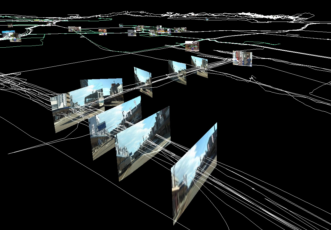
This project, which focuses on the location of the camera and bus itself in relation to its path and streets, tries to map out its route in a 3D space.
Now Microsoft is expanding on this idea to a revolutionary extreme.
http://labs.live.com/photosynth/
View this video, as it explains the depth of this project. In short, it is trying to chronicle every photo on earth, comparing features and building a 3D world.
Here is NASA's alternative to Google Earth: http://worldwind.arc.nasa.gov/
ImprovEverywhere: They Cause Scenes
Monday, October 02, 2006
ibelt process and reaction: Marie
Brandon and I originally wanted to do a piece on caffine and how it effects the body. We then branched towards body sounds in general. At first we were going to put speakers into soda bottles and have the speakers vibrate the soda, but we could not think of a good way to execute this. So we came up with the idea to put the speakers directly on the body and have the vibrations affect the organs that actually make the sounds. We got a belt because that would put the speakers in the right place, found 7 speakers, and hooked them up to three different audio sources of digestive sounds that we found, made, and edited.
I really like the way this piece turned out, and how much it disturbed everyone to wear it. If I were to make it again, I would have more powerful speakers, all the same size and shape. That way they would fit better into the belt and look better. I would want to have the wires built inside the belt, and have them exit in one end all tied together in a long cord so people could move around in it more. I would also be interested in making more for different parts of the body.
I think our piece, save for the craft, turned out really well. People grasped the concept right away without us saying anything, and we got the right reaction out of everyone.
I really like the way this piece turned out, and how much it disturbed everyone to wear it. If I were to make it again, I would have more powerful speakers, all the same size and shape. That way they would fit better into the belt and look better. I would want to have the wires built inside the belt, and have them exit in one end all tied together in a long cord so people could move around in it more. I would also be interested in making more for different parts of the body.
I think our piece, save for the craft, turned out really well. People grasped the concept right away without us saying anything, and we got the right reaction out of everyone.
Sound Project - Experiences of Dom and Kim
For our project we began thinking about visualizations with sound, and how sound can be made experienced as both an auditory and visual experience. We experimented with different surfaces like sheet metal and plexiglass in conjuntion with speaker vibrations and what surfaces yielded better effects. Our experiments with water and oil in water along with sound vibrations didnt work out exactly like we desired so we then focused on the movement of fine particles on a surface, as seen in the salt art piece. We began to work with coffee grounds in order to support our idea caffeine and in realtion to the body. At first we tried using piazo speakers with amps in order to pick up the sound of coffee pouring on to different surfaces (perhaps from a pendulum) but we had lots of trouble getting the amps to function correctly.
After that we began looking at the surround sound system and how we could utilize the different speakers in our piece. We worked in both premiere pro and final cut in order to produce of 5.1 surround sound file, but one the wav was exported it would not burn onto any cd. However we did manage to activate the speakers we wanted to through tone frequency rather than audio channels, so we used audacity to play with tones and what numbers made which speakers vibrate. Our idea evolved into a kind of waterfall like installation where coffee grounds circulated to the bottom through the vibrations of the different tones coming through the speakers. This idea of coffee grounds gradually gathering in a time released manner came from our original idea of coffee pouring out through a sack hanging on a swing,
Most of our problems in the creation of the piece involved technical things and narrowing our idea, vs working on 3 seperate ones at the same time. I liked the effect created by the sound vibrations, and the coffee definitely moved gradually from the top to the ground surface. I think to improve it, we might combine the idea of the breakfast table with our created speaker structure. Perhaps like what some people said, and have the speakers on the table itself or coming through the table or something, Overall though I am pleased with the project, and i like that it became something that explored all of the senses like touch, smell, sound, and visual image.
After that we began looking at the surround sound system and how we could utilize the different speakers in our piece. We worked in both premiere pro and final cut in order to produce of 5.1 surround sound file, but one the wav was exported it would not burn onto any cd. However we did manage to activate the speakers we wanted to through tone frequency rather than audio channels, so we used audacity to play with tones and what numbers made which speakers vibrate. Our idea evolved into a kind of waterfall like installation where coffee grounds circulated to the bottom through the vibrations of the different tones coming through the speakers. This idea of coffee grounds gradually gathering in a time released manner came from our original idea of coffee pouring out through a sack hanging on a swing,
Most of our problems in the creation of the piece involved technical things and narrowing our idea, vs working on 3 seperate ones at the same time. I liked the effect created by the sound vibrations, and the coffee definitely moved gradually from the top to the ground surface. I think to improve it, we might combine the idea of the breakfast table with our created speaker structure. Perhaps like what some people said, and have the speakers on the table itself or coming through the table or something, Overall though I am pleased with the project, and i like that it became something that explored all of the senses like touch, smell, sound, and visual image.
Post-project thoughts Lyuba
It seems that this object could go in several directions from here, but since my focus has been the issues surrounding meditation, it makes sense to push it more toward the noise meditation chamber (anti-anechoic chamber) and away from the filter through which to hear the outside world concept. This would involve adjusting the helmet to be more visually relevant to the subject matter and physically more encompassing of the skull, with speakers positioned closer to ear level and more frequently around the helmet perimeter in order to surround the skull with a pulsating sea of sound. An old fashioned hairdrier comes to mind, recallign images of retro space science experiemts. The apparatus can be installed in conjunction to a chair, reminiscent of both the barber shop and the electric chair, bringing the 2 together in the office of a sort of Frankensteinian mad scientist who aims to adjust the brain waves of the subject in order to force an understanding sound and how people hear sound or don't hear it. The subject may even be strapped in so that there may be no confusion about the intent of this apparatus. Forced meditation? A school for the ear brain, preparing it for the real audio world outside the helmet. This can be equivalent to the sort of audio-visual (minus chemical) training that is present in some popular movies about the creation of human war machines or sane individuals (A Clockwork Orange for example).
Final Sound Project
Process- I knew that I wanted to work with trash. I wanted to work with discarded things. After gathering trash from various sites I put everything together and started letting ideas come. I had a baby cradle, a child's toy basketball hoop, small furniture, home things, parts from a childs dresser, some rows of nails for a nail gun, a chimney topper... I realize that the idea I came up with is pretty much induced from my mental situation for the past month and that what I saw is basically just what I wanted to see- a neglected child/ dysfunctional family. I started to work reconstructing a scene. I took apart an old ottoman and ripped it up to build a bear. I hand sewed it and stained it so that it would smell. I broke the beer bottles I found and thought of listening to a substance abusing parent. I basically used these things to create a dialogue between the parties involved in a ficticious (sp?) child abuse case. It may seem like I didn't spend any money on this project... and I was told to spend more... but I have to protest this-- I spent a crapload of money on this project buying supplies I didn't have and investing in a lot of speakers that I had to have. I would make the parent's beer bottle speaker work better for the next time if there ever would be one. I hadn't tested out kim's computer with my speaker until the last minute, but I would have used an amp today if I had the double ended cable for it. I just didn't know that the cd player in the room would crap out on me so soon... it was working really loudly yesterday. As for everything else, I could have turned it all up louder (I had that technology worked out AND available-- my minidisk is loud) I just chose not to because I figured people would get close. So technology wise-- it WAS worked out... it was just the beer bottle speaker that was messed up and I guess my view of how things would be heard to different people was messed up to0.
Process/Thoughts on "Internet-speak" proj.
My project was about the connections between the online dialogue commonly used by users on Instant Messanger programs and normal dialogue. The setup consisted of a laptop connected to a 3-speaker system playing duplicated male and female voices, both saying abbreviated, commonly used 'Internet chat' words, or "Leet (l337)" talk with background noise. Two speakers were placed on chairs, while the bass speaker was placed under the computer. On the computer screen were flashing words of the same dialogue the voices were saying, only non-abbreviated.
Research was conducted on the word "Leet" in Wikipedia, which described it as an altered "modification of written text" used primarily in chatrooms and online games. My purpose for the project was to invert the intended usage of "leet-speak": voices speaking in "leet-speak" instead of normal vocabulary, and vice versa.
It was discovered during the presentation that the speakers would make a more realistic relationship to the viewer by having them placed under the chairs while the viewers sit in them, rather than having the viewers crouth between the chairs with speakers on them.
In expanding the modifications to this project, the bass speaker could have been turned down or muted somehow, since it distracted the speech from the two speakers under the chairs. Also, with two viewers facing each other on the chairs, two visual aids of the computer screen could have been projected for them to see, instead of just having the solitary computer screen to view.
Research was conducted on the word "Leet" in Wikipedia, which described it as an altered "modification of written text" used primarily in chatrooms and online games. My purpose for the project was to invert the intended usage of "leet-speak": voices speaking in "leet-speak" instead of normal vocabulary, and vice versa.
It was discovered during the presentation that the speakers would make a more realistic relationship to the viewer by having them placed under the chairs while the viewers sit in them, rather than having the viewers crouth between the chairs with speakers on them.
In expanding the modifications to this project, the bass speaker could have been turned down or muted somehow, since it distracted the speech from the two speakers under the chairs. Also, with two viewers facing each other on the chairs, two visual aids of the computer screen could have been projected for them to see, instead of just having the solitary computer screen to view.
Project 1 Thoughts
We reworked our sound project from body sounds to just indigestion. We began with soda bottles and having the speakers vibrate the liquids in the body. The project at that point was a more physical representation of the body's digestion. We went away from that because we could not come up with a good way to place the speakers in the bottles. Then we thought of placing the speakers directly on the body. We found 7 speakers and put them inside the belt. Then we found and made digestive sounds that vibrated the speakers enough so that whoever wore the belt would feel the vibrations and become aware of the digestive sounds the body produces. The overall feeling was supposed to be uncomfortable and that is what we achieved. We were pleasantly surprised when most people who put the belt on wanted to take it off almost immediately. Since the project became one about indigestion, it was supposed to give that sense of anxiety and discomfort that people did feel. The speakers that worked the best at this were the larger ones that had a lot of padding built into them. They could produce a lower range of sounds and could therefore vibrate the body. If we could change out the smaller speakers into more powerful ones, we would. Also, if possible, we would like to make it more portable while still allowing for multiple audio sources. At the time, we have 3 audio sources that allow for a wide range of feelings and sounds to be produced through the belt. If we could continue with that path while making it smaller and lighter, it would work better as a whole. Overall we seem very pleased with our work, and we got the response we wanted from everyone that put the belt on.
-Brandon and Marie
-Brandon and Marie
thoughts on our project
me and dominique went through several different experiments for this project. we were very interested in the vibrations that can be created through that of sound. our process started through our thoughts on the sand grain piece that created patterns on sheet metal. we wanted to try to mimic that effect with either water or coffee grounds. although we came up with interesting movements through water, we were unable to think of a good concept for the piece besides it being something interesting to look at. then we started to think of addiction and found that coffee grounds would probably be the best thing to work with. our first tests with the coffee grounds showed us that we were not going to be able to create patterns with it using the technology that we have. so we created mini speakers attached to piezo's which were also attached to amplifiers, but that didn't turn out too well either. we were thinking that it was because of the amplifiers or our connections since we tried to just amplify some sound through some home made speakers and it didn't work even though we figgeted with it so much. our next thoughts were to use the surround sound with 5:1. we created it through premiere and final cut, and we were able to export a wav file with the 6 channels, but for some reason we were unable to export it onto a cd..... so we had to alter our plans a little more; experimented with the different frequencies on tone to see which speakers were affected the most by which frequencies. once the experiment was logged, we created an audio piece where it was supposed to invoke a sort of caffine intake; first you get a buzz, then it slows down, if you sip more you get a bigger buzz, and eventually it'll hit you at once, the caffine high, which is usually short and then it goes low and fades away into nothing. i would like to have had a longer sound piece to just make people wonder what's going on. if this piece was to be placed in a gallery for interaction purposes, people probably wouldn't even realize the meaning of the changes in frequencies. also, the idea about placing the speakers inside a cut circular table is a really good idea and i would like to expound on that. i'm sure i could find a round table somewhere and just get a jigsaw to cut a center out of the table, which would bring the piece together. all in all, i think through our experimenting and the product of our experiments, i am happy with what we came up with, but in the end, there is always something that can be improved on when it comes to art work, and i definately agree that we could change around some stuff.
Sunday, October 01, 2006
Project thoughts
“To understand these phenomena let us imagine that a person who is reading quietly is suddenly disturbed by a loud noise. If the same sound is then repeated with a few seconds later his attention will again be diverted, only not as strongly nor for as long a time. If the sound is then repeated at regular intervals, the person will continue reading and become oblivious to the sound. A normal subject with closed eyes produces alpha waves on an EEG tracing. An auditory stimulation, such as a loud noise normally obliterates alpha waves for seven seconds or more; this is termed alpha blocking. In a Zen master the alpha blocking produced by the first noise lasts only two seconds. If the noise is repeated at 15 second intervals, we find that in the normal subject there is virtually no alpha blocking remaining by the fifth successive noise. This diminution of alpha blocking is termed habituation and persists in normal subjects for as long as the noise continues at regular and frequent intervals. In the Zen master, however, no habituation is seen. His alpha blocking lasts two seconds with the first sound, two seconds with the fifth sound, and two seconds with the twentieth sound. This implies that the Zen master has a greater awareness of his environment as the paradoxical result of meditative concentration.”
The above quoted EEG experiment has proved that the non-meditator's mind becomes insensitive to the environment and his mind functions on habituation while the meditator's mind remains alert to the outside world. This is paradoxical to meditative concentration. Simply because the sensitivity becomes sharper in the meditative mind, the meditator becomes more and more sensitive to the condition of the world.
REFERENCES 2. “Elements of Buddhist Meditation” Prof Shantha Ratnayake
The above quoted EEG experiment has proved that the non-meditator's mind becomes insensitive to the environment and his mind functions on habituation while the meditator's mind remains alert to the outside world. This is paradoxical to meditative concentration. Simply because the sensitivity becomes sharper in the meditative mind, the meditator becomes more and more sensitive to the condition of the world.
REFERENCES 2. “Elements of Buddhist Meditation” Prof Shantha Ratnayake
Subscribe to:
Posts (Atom)